Blog: A blighted birding patch (just SE of the eagle sanctuary)

Blog: A blighted birding patch (just SE of the eagle sanctuary)

Administrator
|
This post was updated on .
As
is evident to anyone who reads my posts, our recent birding has been
carried out within fairly restricted boundaries. In Illinois, it was
our now extinct and lamented "back yard" prairie (Remembering
birds in a vacant lot). In Florida, a convenient
wetlands preserve adjacent to our subdivision is a scarred but welcome
haven for resident and migratory species.
Since moving to south Florida in 2004 I have recorded a respectable 126
bird species in this local tract. Most are documented among over 5,500
photos that may be viewed in this FLICKR set: West Miramar Water Conservation Area
As happened with my Illinois "back yard" patch, this area is slated for massive development in the near future. This time it will not succumb to residential subdivisions or shopping centers. The mile-long stretch of gravel road that now provides access (Miramar Parkway/SW 196th Avenue right of way) will be paved and become a four-lane high speed parkway, to connect two major highways, I-75 and US-27. Most of the wetlands will be surrounded by 13-15 foot levees and flooded to a depth of up to 4-5 feet to become a huge retention reservoir. We hope that some terrestrial habitat is included in the project, to mimic the hardwood hammocks of the original Everglades. The Harbour Lakes mitigation area with its two lakes will remain outside the new reservoir, but the roadway will run along its eastern and northern edges. This photo, which I took at sunrise just this past week, is the gravel right-of-way which will become the planned parkway. 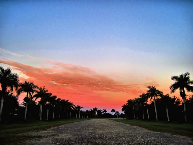
The very spot, where I stood to take this picture of an immature Great Blue Heron and Great Egret with an assemblage of Roseate Spoonbills and White Pelicans in the Harbour Lakes wetland, will be paved and busy with traffic. 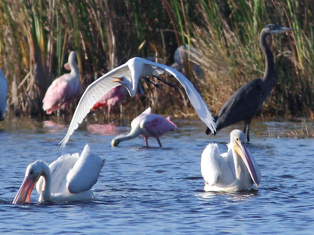
The high levee will run along this row of abandoned telephone poles, dashing hopes that they might serve as sites for Osprey nest platforms. The open wet prairie to the right of the photo is part of the Harbour Lakes mitigation area that will not be included in the impoundment and presumably will continue to be actively maintained as a preserve. 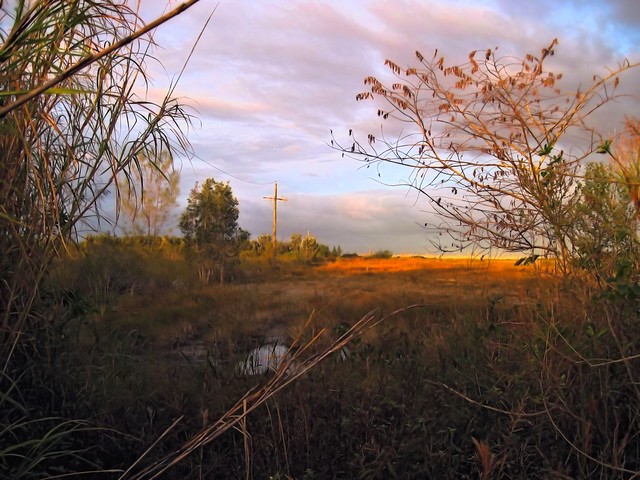 Part of the US Army Corps of Engineers plan to restore sheet flow to the historic Everglades, the reservoir will serve to prevent diversion and seepage of rain water, which now flows in canals directly out of the Everglades to the ocean. The retained water will recharge the aquifer and keep salt water from intruding into the water table that supplies the residents and industries of the entire populated southeastern Florida peninsula. A system of pumps and waterways will regulate water flow, and biologic action in the standing water will remove agricultural pollutants such as phosphorus and nitrogen. As this map illustrates, the reservoir, outlined in red and designated by the US Army Corps of Engineers as "Impoundment C-9," will be 3.5 miles from north to south, and up to 1.2 miles wide. To get an idea of the size of this project, US Highway 27 (Okeechobee Road), to the left, is about 5 miles west of Interstate I-75. At the northern edge, the small rectangular woodland that contains the Bald Eagle nest which we succeeded in having declared a sanctuary, will be spared. 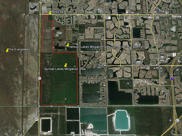
Much of the land to be inundated had been "permanently" set aside by developers to compensate for the damage done to the Everglades by construction of subdivisions. The dedicated preserve c onsists of agricultural fields that, in the early 1900s, were "reclaimed" from the Everglades by draining and filling. Under the mitigation plan, these lands were subsequently managed to become a water conservation area. Drainage ditches were blocked and low levees were constructed around its perimeter. Exotic vegetation was removed. Although isolated from the main Everglades preserve (which is west of US-27) it collected rain water during the summer and dried out in winter, loosely mimicking the ebb and flow of the historic wild lands. When we first came to Florida, the land was returning to a more natural state of wet prairie where Sawgrass and Spikerush flourished. With announcement of the C-9 project, all maintenance ceased and now the area designated for the reservoir is rapidly returning to a woodland populated by Australian Pine, Melaleuca, Brazilian Pepper and other invasive shrubs, grasses and vines. This is an example of one area that was a wet prairie only about 7 years ago. Now it is choked with shrubs. 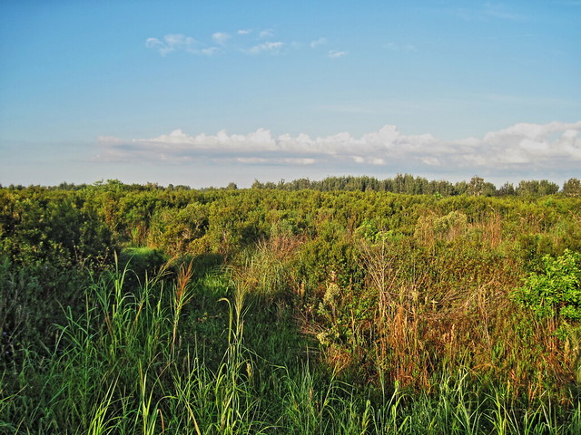
After it is flooded, upland species such as Bobcat, White-tailed Deer will be evicted. This Bobcat eyed our approach as it sat right in the middle of the gravel road... 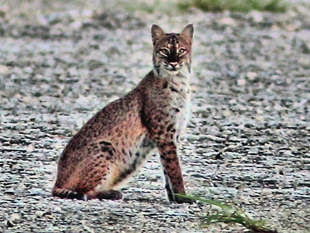
...and an eight-point buck peered out from the edge of the road. 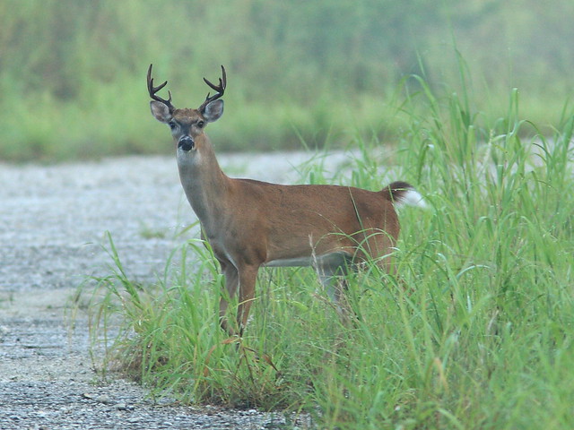 Other upland species will lose their habitat, such as Raccoons...  ...and Florida Box Turtles, both also captured as they ventured out on the roadway. 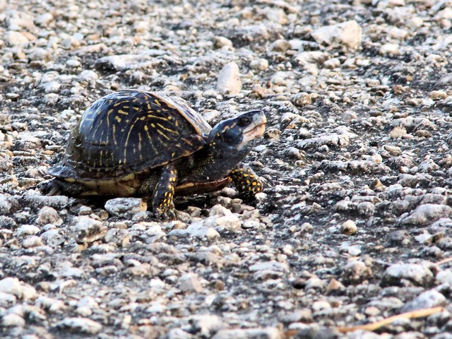
Of course, when the project is completed, it should support a rich habitat for fish-eating species such as herons, Osprey and Bald Eagles. Tricolored Heron: 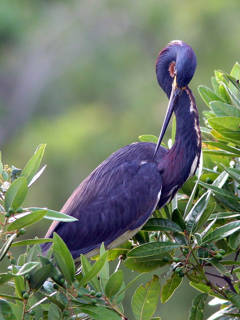
Osprey: 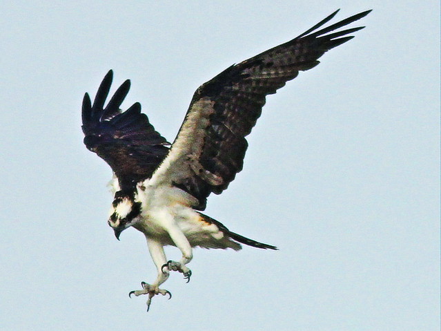
Bald Eagle with fish stolen from Osprey, on the Harbour Lakes mitigation area: 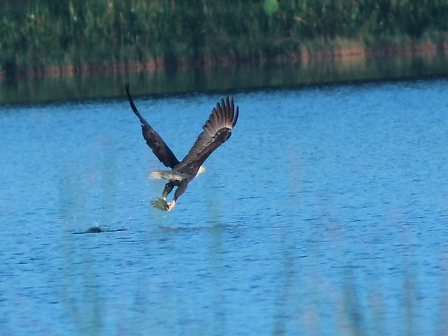
In the meantime, recreational off-road vehicle drivers are having their way with the wetlands, as efforts to restore them have been abandoned. Supposedly, under state law, these lands held "in perpetuity" under deed restrictions and conservation easements will be replaced by "similar" acreage somewhere else in the State of Florida. Before, during wet season: 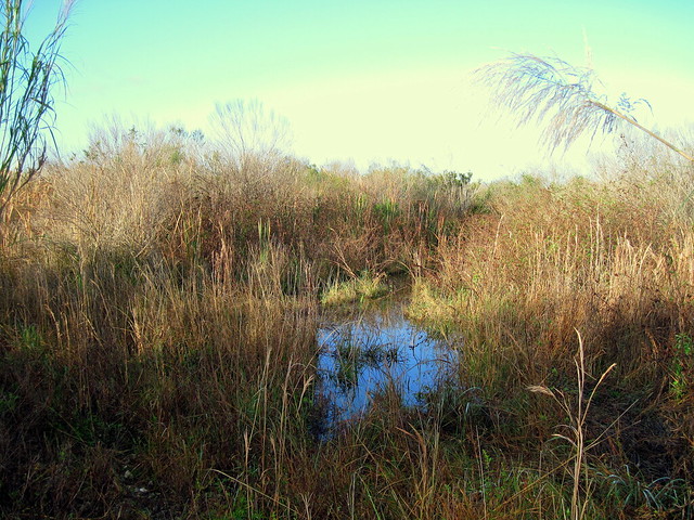
Same location after visited by the all-terrain vehicles: 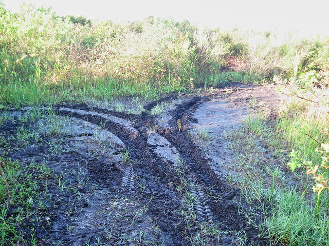
Another example, on posted water conservation easement (note that the "No Trespassing" sign has been knocked over by the fun-seekers): 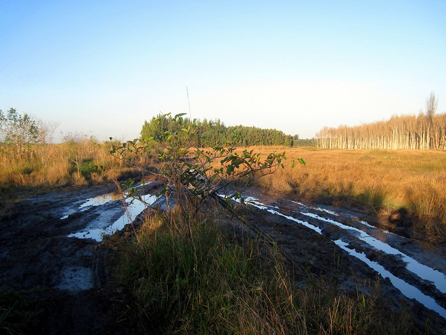
Ken Schneider
Web site: http://rosyfinch.com Blog: http://rosy-finch.blogspot.com Photos: <http://flickr.com/photos/rosyfinch> |
«
Return to Local Habitat and Inhabitants-- Photos and reports
|
1 view|%1 views
| Free forum by Nabble | Edit this page |