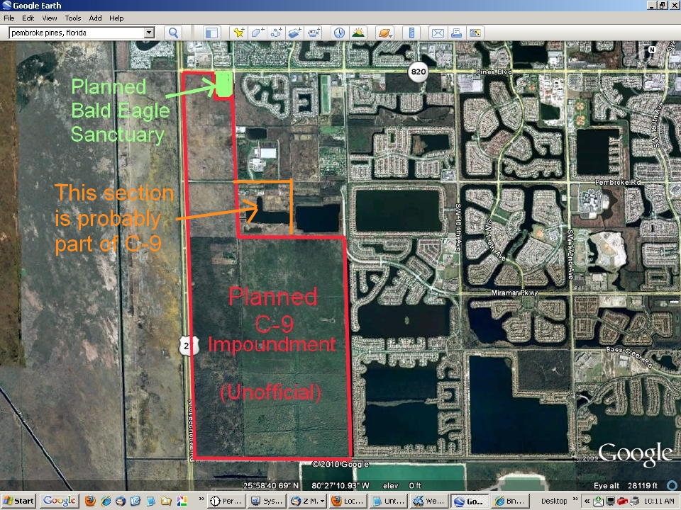
Based upon my examination of Comprehensive Everglades Restoration Project (CERP) documents, this overlay is my best impression of the boundaries of the planned C-9 impoundment to be constructed to the south and west of the eagle nest woodland. The red lines represent the levees that will contain a maximum of about 4 feet of water.
The plan for this project is now being reformulated, and funding issues have not been resolved. My understanding is that it will not get underway for several more years. C-9 is planned to serve as a rainwater reservoir that will also retain overflow from the planned C-11 impoundment to be constructed east of US-27 in Weston. The C-11 is on track to be completed before C-9.